New Type Of El Nino Could Mean More Hurricanes Make Landfall
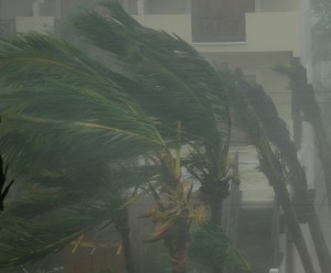
El Niño years typically result in fewer hurricanes forming in the Atlantic Ocean. But a new study suggests that the form of El Niño may be changing potentially causing not only a greater number of hurricanes than in average years, but also a greater chance of hurricanes making landfall, according to climatologists at the Georgia Institute of Technology. The study appears in the July 3, 2009, edition of the journal Science.
“Normally, El Niño results in diminished hurricanes in the Atlantic, but this new type is resulting in a greater number of hurricanes with greater frequency and more potential to make landfall,” said Peter Webster, professor at Georgia Tech’s School of Earth and Atmospheric Sciences.
That’s because this new type of El Niño, known as El Niño Modoki (from the Japanese meaning “similar, but different”), forms in the Central Pacific, rather than the Eastern Pacific as the typical El Niño event does. Warming in the Central Pacific is associated with a higher storm frequency and a greater potential for making landfall along the Gulf coast and the coast of Central America.
Even though the oceanic circulation pattern of warm water known as El Niño forms in the Pacific, it affects the circulation patterns across the globe, changing the number of hurricanes in the Atlantic. This regular type of El Niño (from the Spanish meaning “little boy” or “Christ child”) is more difficult to forecast, with predictions of the December circulation pattern not coming until May. At first glance, that may seem like plenty of time. However, the summer before El Niño occurs, the storm patterns change, meaning that predictions of El Niño come only one month before the start of hurricane season in June. But El Niño Modoki follows a different prediction pattern.
“This new type of El Niño is more predictable,” said Webster. “We’re not sure why, but this could mean that we get greater warning of hurricanes, probably by a number of months.”
As to why the form of El Niño is changing to El Niño Modoki, that’s not entirely clear yet, said Webster.
“This could be part of a natural oscillation of El Niño,” he said. “Or it could be El Niño’s response to a warming atmosphere. There are hints that the trade winds of the Pacific have become weaker with time and this may lead to the warming occurring further to the west. We need more data before we know for sure.”
In the study, Webster, along with Earth and Atmospheric Sciences Chair Judy Curry and research scientist Hye-Mi Kim used satellite data along with historical tropical storm records and climate models.
The research team is currently looking at La Niña, the cooling of the surface waters in the Eastern and Central Pacific.
“In the past, La Nina has been associated with a greater than average number of North Atlantic hurricanes and La Nina seems to be changing its structure as well,” said Webster. “We’re vitally interested in understanding why El Niño-La Niña has changed. To determine this we need to run a series of numerical experiments with climate models.”


